The ubiquitous Google Maps is so useful that we can even use it to design our own RC race track. Here’s how you do it.
This feature is only available on Google Maps desktop, not on the mobile app.
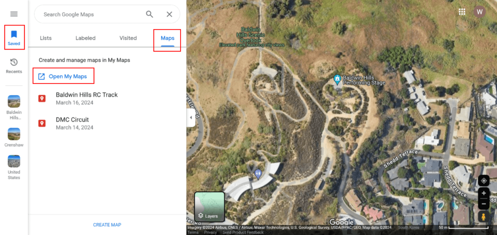
Go to Google Maps on your desktop and go to the Saved menu on the left-hand side. Then, select the Maps tab. Inside the tab, click on the Open My Maps link.
Once you’re on My Maps page, click on Create a New Map button. Begin searching for your track location.
Add a Walking Route
Click on the Draw a Line button on top and select Add Walking Route.
Now, start by clicking on the map to pinpoint the starting location of your track route. Then, begin tracing the route on the walking path available while designating waypoints along the way. You may end your track by clicking back at the starting point.
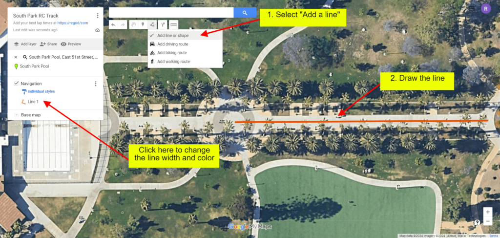
Add a Line
Sometimes, a walking route is not available on the map. If so, you may draw a line instead. To draw a line, click on the Draw a Line button on top and select Add a line or shape. Then, begin by drawing a line on the map. You can also change the color and width of the line. To draw multiple connected lines, start drawing a new line by clicking at the end of one line. The lines will interconnect.
Give a Name to Your Map
Next is to give your map a name and enable sharing by clicking on the Share button on the top left side.
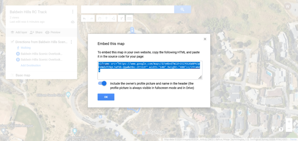
The final step is to get the HTML embed code. Go to the three-dotted menu on top and choose Embed map on my site option. Copy the HTML code and paste it on the form on the RC Grid website when adding a track.